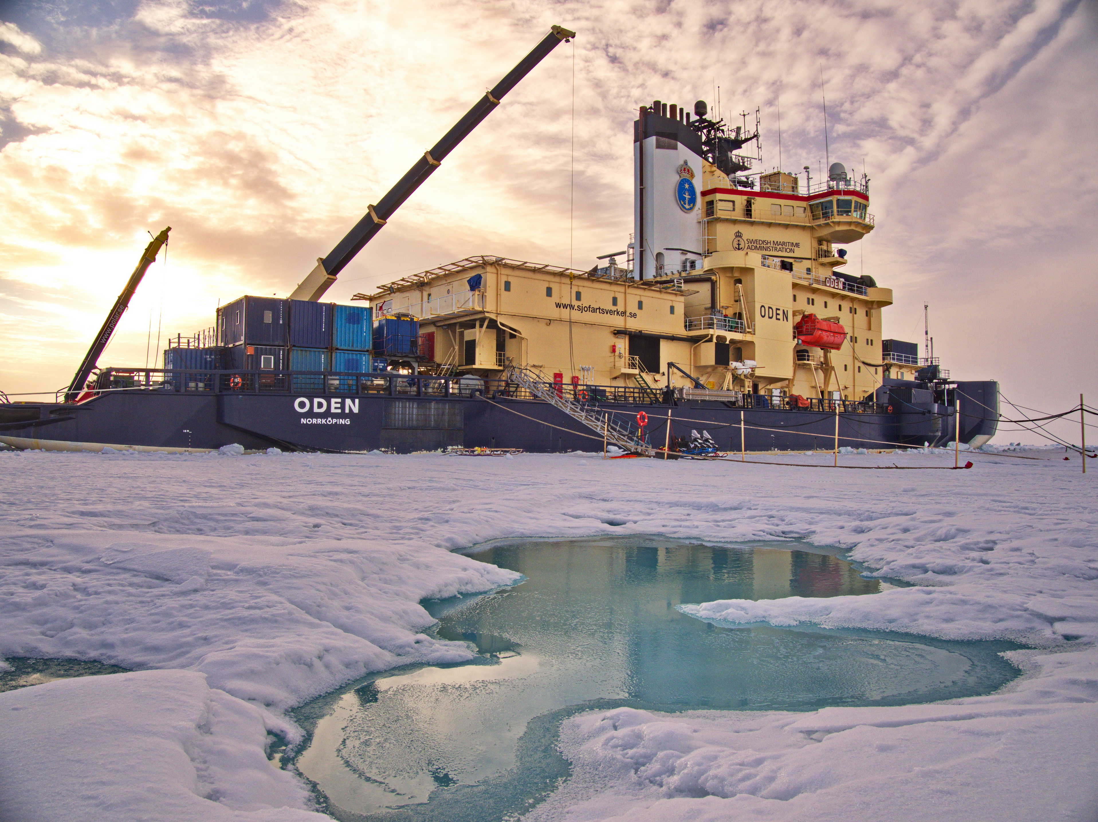
Icebreaker Oden moored to an ice floe at the end of August, with a partially frozen melt pond in the front with it intensive turquoise color. The wooden stakes hold the power lines that would otherwise melt into the ice and be impossible to remove before going home. The ship's big crane holds the gangway; this way it can be rapidly raised in case a polar bear comes along. The snowmobiles by the gangway were electrically driven to minimize pollution. (c) M. Tjernström 2018
During Arctic Ocean 2018 (AO18) expedition on the Swedish icebreaker Oden an embryo to an atmospheric observatory was launched by the Arctic Climate Across Scales project (ACAS), a YOPP-endorsed project, funded by the Knut and Alice Wallenberg Foundation, and co-funded by INTAROS.
AO18 started from Longyearbyen on Svalbard at the beginning of August and ended, also in Longyearbyen, on 21 September. After a short visit by the North Pole on 12 August, AO18 anchored to and drifted with an ice floe for about one month, mid-August to mid-September, to allow science teams on board continuous access to the ice for measurements that had to be conducted away from the ship. This ice drift started at ~N89.5° and ended about one degree further south, drifting back and forth between E30° and E50°; that far north longitude distances are rather small.
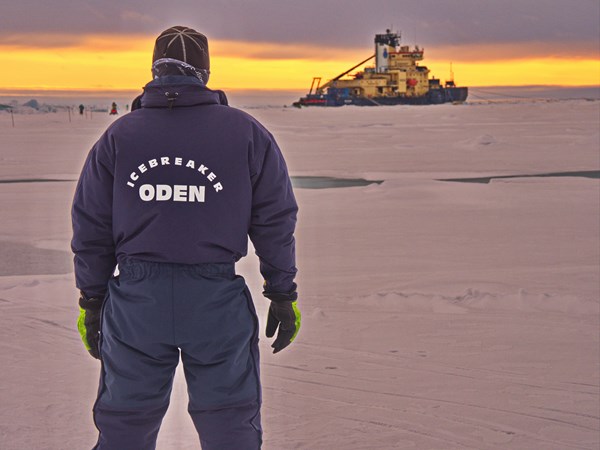
When the work started to settle into routine and when the weather permitted, a ski and walk track was opened up along the edge of the flow. A logistics crew was positioned along this track to allow anyone who wanted to ski, jog or just take a walk to do so without having to bring a gun for polar bear protection. In this photo a member of the Oden's crew, one of the first officers in fact, is looking at Oden from some distance as the sun gets closer to the horizon. (c) M. Tjernström 2018
The atmospheric observatory included a weather station on the Oden's top 7th deck for standard meteorological observations, augmented with instruments for incoming broadband radiation, surface temperature by downward-looking infrared thermometers, a cloud base lidar for cloud information and backscatter profiles and a present weather station measuring precipitation intensity and visibility. ACAS/INTAROS also deployed an eddy-covariance system at about 20 meters above the surface in a mast at the bow of the ship, measuring turbulent surface fluxes of momentum, heat and water vapor and, through a collaboration with Stockholm University, also carbon dioxide and methane. Together this allowed monitoring all the components of the surface energy budget continuously from the end of the melt season through the onset of the surface freeze-up.
As a contribution to the Year of Polar Prediction (YOPP) and in collaboration with Environment and Climate Canada and the UK Met Office, radio soundings were launched every six hours and the results were shared globally on the Global Telecommunication Service (GTS). The final atmospheric observatory will additionally include a cloud radar and a microwave temperature and humidity profiler; during AO18 a collaboration with Leeds University (UK) and the Natural Environment Research Council (NERC)(UK) ensured these measurements.
This suite of observations allowed monitoring the atmosphere, including its dynamic and thermodynamic state and clouds, from the surface and through the whole troposphere (the part of the Earth's atmosphere where weather occurs). Many other projects were also active on board and on the ice, most of which were focused on aerosol and cloud observations but oceanography observations and measurements of snow- and ice-chemistry.
More information on ACAS can be found here.
For more information on the expedition, visit the Arctic Ocean 2018 site.
You can check out all the observing sites assessed by INTAROS in this interactive map.
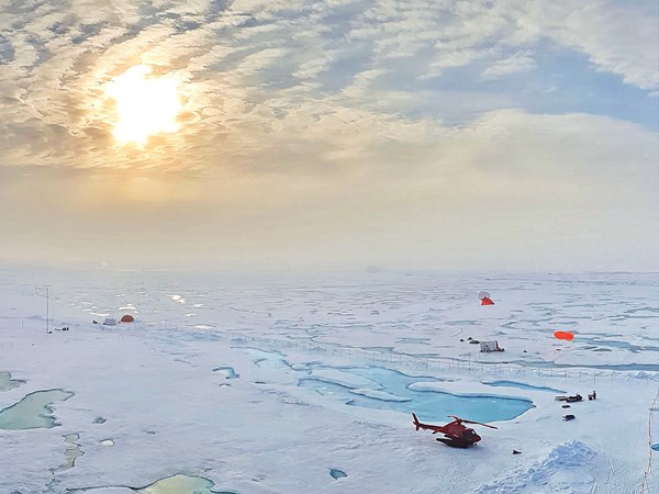
A view of the ice camp showing the oceanography and micro-meteorological sites to the left and the tethered sounding site to the right; note the two red tethered balloons. On the far side of the ice floe, well away far into the mist in this photo, was also an open-water site located at the edge of a large open lead. The helicopter is parked on the ice since that makes it easier to take off and land without involving the ships fire-fighting team. (c) M. Tjernström 2018
01 July 2018